Comprehensive Mapping and Data Solutions


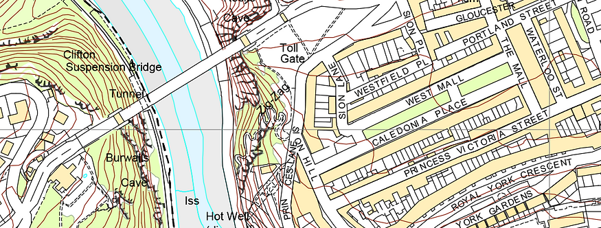

OS VectorMap Local enables customisable base mapping with street level detail that is highly accurate, detailed and reliable.

1:25 000 Scale Colour Raster is the digital equivalent of the (orange) OS Explorer paper map series

1:50 000 Scale Colour Raster is the digital equivalent of the (pink) OS Landranger paper map series

OS Open Map – Local (OML) is one of the most detailed generalised open base mapping products available and is designed to provide contextual base mapping for your applications or web pages

OS VectorMap District is a mid-scale digital raster and vector mapping product that gives a district level view of a Great Britain vector map

1:250,000 Scale Colour Raster is a small-scale digital map providing a regional view of the landscape

MiniScale is a free small-scale digital map of Great Britain in a single data file that clearly shows towns and cities, motorways, major roads, railways and airports.
What is base mapping?
Base mapping provides the geographic foundation for displaying, analysing and understanding other spatial information. It gives users a consistent visual reference for locations, including features such as roads, buildings, settlements, transport networks and other geographic features.
Digital base maps are widely used in GIS, planning, surveying, engineering, environmental assessment and infrastructure projects. Depending on the scale and level of detail required, different mapping products can provide anything from detailed street-level information to broader regional or national views.
CentremapsLive provides a range of digital base mapping products for Great Britain, including vector and raster datasets from Ordnance Survey. These can be used as standalone mapping or combined with other geographic datasets to provide context for more detailed analysis.
Choosing the right base mapping product
The most suitable base mapping dataset depends on the scale, level of detail and intended use of your project. Detailed street-level mapping is useful for site-specific applications, while smaller-scale mapping provides a broader view of towns, regions and the wider landscape.
For detailed local mapping:
Use OS VectorMap Local for highly detailed, customisable street-level mapping.
For district-level mapping:
OS VectorMap District provides a broader view while retaining useful geographic detail.
For regional and national mapping:
1:25,000, 1:50,000 and 1:250,000 Scale Colour Raster products provide progressively broader views of the landscape.
For web and application development:
OS OpenMap Local provides generalised base mapping designed to provide geographic context within applications and web pages.
For a simple national overview:
OS MiniScale provides a small-scale view of Great Britain showing major towns, cities, roads, railways and airports.
What is base mapping used for?
Base maps provide geographic context for a huge range of professional applications, including:
Planning and development
Use base mapping to understand the location and surrounding context of development sites and infrastructure.
GIS and spatial analysis
Use digital mapping as a foundation for adding, analysing and visualising other geographic datasets.
Engineering and surveying
Provide a consistent geographic reference for infrastructure projects, surveys and design work.
Environmental assessment
Combine base mapping with environmental datasets to understand land use, natural features and site conditions.
Property and land management
Visualise buildings, roads, land and other geographic features across individual sites or larger areas.
Combine base mapping with other datasets
Base mapping can provide the geographic foundation for a wide range of additional datasets. Combining different layers allows users to build a more complete picture of a site or area and carry out more detailed analysis.
Base mapping is often used alongside other mapping and geographic datasets to provide additional context and detail. Depending on your project, you may also require OS MasterMap for detailed topographic mapping, Aerial Imagery for high-resolution photographic information, Height Data for terrain and elevation analysis, National Tree Map for tree and canopy information, Land Registry Mapping for property information, Field Boundary Data for rural land analysis or the National Geographic Database (NGD) for richer geospatial data and feature attributes.
Base mapping formats
Depending on the product selected, CentremapsLive base mapping can be supplied in formats suitable for different workflows, including:
TIFF
PDF
SHP
Vector data formats